
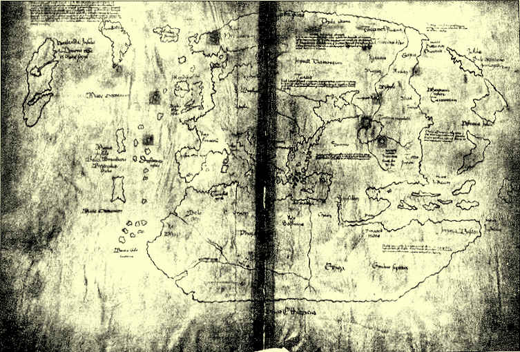
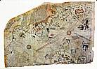
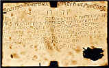
The Vinland Map
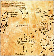
top left: "Vinland" - center: Greenland
right: Europe bottom right: Africa
The New York Times 14 September 2002
How a Jesuit priest fooled Adolf Hitler
and lots of other people
The Vinland Map, describing the Viking discovery of North America, has been stuck in scholarly deadlock ever since it was donated to Yale University by philanthropist Paul Mellon in 1957. It is either a rare medieval artifact the first cartographic representation of the continent or else a modern fake.
One study, published August 2002 in Radiocarbon, gives a date for the map's parchment of 1434, indicating that the map could be authentic. (It is pretty well established that the intrepid Vikings had settlements in North America around the year 1000). But a second study, published simultaneously in Analytical Chemistry, comes to the opposite conclusion: Presence of the mineral anatase in the map's ink indicates a 20th-century origin even if the parchment is far older.
But now the forgery camp may have some fresh ammunition. A Norwegian historian says she has found the forger: a German Jesuit priest named Josef Fischer, whom she believes made the map partly to protest the Nazi regime.
He would have made the map not for profit and not to flaunt it publicly, but mostly as a private protest,said the historian, Kirsten A. Seaver, author of a book about the Viking exploration of North America.I'm very convinced it was done to tease the Nazis.
Politics and religion are at the heart of Seaver's intricate case against Father Fischer, which she has laid out in several scholarly articles and is turning into a book that she hopes to publish next year.
The Jesuit is an obvious suspect. He was an avid scholar and collector of old maps, credited with discovering the now legendary Waldseemüller world map from 1507 the first to use the word America.
He published a book in 1902 in which he argued that the Norse had been to this continent long before Christopher Columbus. With little evidence, he was convinced a cartographic record of the venture must exist.
Seaver argues the holy father would have been outraged by the Nazis' persecution of Jesuits. In 1938, they forced the sale of Stella Matutina, the Jesuit College in Feldkirch, Austria, where Father Fischer had taught and was living in retirement. (He moved to Münich, the very Brown center, the next year and died in 1944.)
At the same time, Seaver contends, Father Fischer would have been appalled to see ancient Norse history put to use as Nazi propaganda. The Third Reich did a bustling traffic in ersatz Norse art and artifacts, she points out, as German officials saw in the Vikings an Aryan people with territorial ambitions much like their own. In particular, a Viking conquest of North America would supply a perfect rationale for the Reich's empire-lust overseas.
By making the Vinland Map, Father Fischer would thus seem to be fulfilling a cherished Nazi dream. But and here's the rub the map is laden with Catholic imagery. The legend in the top left corner refers not only to the discovery ofVinlandbythe companions Bjarni and Leif Eiriksson,but to a trip there soon after by Eric,legate of the Apostolic See and the bishop of Greenland.
This, Seaver argues, was Father Fischer's ruse: to give the Nazis and history a Viking conquest of the New World but to make clear that it was a Catholic one as well.
The map shows two things clearly,she said.The Roman Catholic Church was here first, long before Hitler and the Third Reich could claim any rights to the region, and it showed the Norse had discovered America long before Columbus. Whoever the Nazi authority was who was going to pronounce on such a map in the public eye would have to make a choice. Should the map be discarded because of its Catholic symbolism? Or should they go with the lovely idea of the Norse discovery of America?
Anomalies in the map's legend including its idiosyncratic account of Norse history further implicate Father Fischer, Seaver says, who would have relied on inaccurate secondary sources. But her most tantalizing clue concerns a Czech library that may once have housed the Vinland Map parchment.
When Mr. Mellon purchased the map from a Connecticut rare books dealer in 1957, he also acquired two associated 15th-century works:The Tartar RelationandSpeculum Historiale.The latter volume was incomplete, however, consisting of just the first four sections.
But in a Swiss auction catalog from 1934, Seaver found a listing for a manuscript fragment that appears to be the volume's missing fifth section. The catalog attributed the fragment to the Mikulov Castle library in Brno, a collection that was known for its antique maps and that Father Fischer consulted.
When the library was sold in the early 1930's, Seaver speculates, Father Fischer either bought or was given a bound edition containing bothThe Tartar RelationandSpeculum Historiale,later converting some of the parchment into the Vinland Map.
Also sprach the New York Times on 14 September 2002
I can't help grudgingly admitting that, if that Austrian school even remotely resembled another Jesuit one, Canisius College in Nijmegen (Holland) where I was an inmate for three years, the Nazis may have done one good thing after all.
The map is altogether too good not to be a fake of much later date.
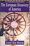 |
Discovery of America By Columbus biographer Samuel Elliot Morison. As fat and solid as you'd expect. Shown is Part II, the Southern Voyages, but I'd advise getting Part I (North) at the same time. |
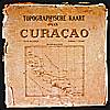 The Werbata Maps |
First topographic maps of Curaçao island, the Colony of Curaçao and Willemstad town, dating from begin 20th century. Reproduced on 2 CD-Roms. |
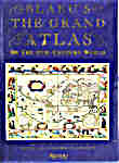     |
Blaeu's Grand Atlas Reproductions of 17th Century Dutch maps. A joy to behold, and relatively cheap, too. Of course they're smaller than the originals. Too bad, but for most of us the only chance to get a look at 'em. |

| Funny map | Paradise map | Piri Re'is map |
 |
 |
 |
| Leo Belgicus the Dutch lion |
fool's paradise Forester fools Forester |
for real still fools lots of people |
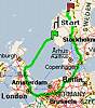
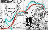
| Internet map | WWII convoys | Francis Drake map |
 |  |
 |
| stupid Yiddish: MicroSov |
The Murmans convoy run Halifax-Iceland-Murmansk |
map and plate: con-trick and prank |


 copyright © by