The Piri Re'is Map
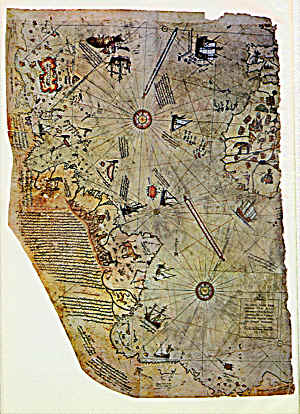
Top right: Spain, West Africa - Top left: North America East coast
Bottom left: South America - Bottom: Antarctica
Not a fake, but...
Piri Re'is was a 16th century Turkish admiral, rather interested in cartography. From what he knew, in 1513 he assembled a map of the world. It's pretty good, considering, but some people tend to get very excited about it.
The story is that Piri Re'is met a pilot who had accompanied Columbus on his three voyages (so far so good), and that this pilot had a very old map that Columbus supposedly had picked up somewhere. And that map showed the outline of Antarctica in remarkably correct detail.
Presto, they jump to conclusions: The map must have been prepared by the people from Atlantis; or by the builders of the pyramids. Or even both at once! Cosmonauts! Gods! Who else could then have known about the existence, even, of Antarctica? There are even stories going the round that, in Turkey, they have a satellite photo of the earth. (Of course, this is kept a secret.)
Well, I don't feel like refuting all this nonsense. But to make clear why I think it nonsense:
To his dying day, Columbus thought he had found a shortcut to East-India; he never thought he had discovered a new continent. Why didn't those know-it-all Atlanteans put that continent on the map?
It was a half theological argument at the time that, for the sake of symmetrical balance, there had to be an Antarctica with antipodes inhabiting it. It was a regular feature of many contemporary maps. Even if it fits the continent under the ice-cap amazingly well (this is one of the arguments), that might be a coincidence. Such things do happen, after all. By the way, they tell me it does not really fit so well, at all.
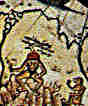
Some other questions: Why do East-India and China not appear on the map? It's a world map, am I right? If that map is so good, why is the Amazon on there twice? Where's the West coast of America? If the Atlanteans were so advanced, why didn't they use a Mercator projection or better? What's the strange dude doing there in the interior of South-America? Might he be an Atlantean? No wonder they were so smart!
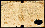
Strange Dude
To sum up me case, your ludship:
The map looks entirely consistent with contemporary techniques.
But some people prefer mysteries to having them solved.
Just type "piri reis" in your search engine...
there's thousands of that kind out there
For the clincher, why didn't the Atlanteans put Atlantis on there?
(that one's easy: It's what Popeye would call a Sekrick!)
There have been theories—what do I say? there still are theories!—some people just won't give up—that there is a hole in the South-Pole where you can enter the earth and find a complete other earth inside.
Ozone hole, yes—but no such entrance has been found.
But what do we know? It may have gotten iced over.Do you know that inside the earth there's a much bigger globe?
from The Good Soldier Schweykby Jaroslav Hasek
The most anti-militaristic book I ever read—and one of the funniest, too!


If you really want to find out about the Piri Re'is map, read
The Piri Reis Map of 1513 by Gregory McIntosh.
If you don't know yet where to look for Atlantis
(and many other, not impossibly even more interesting places)
Lands Beyond by L. Sprague the Camp and Willy Ley.
Curaçao Island live in real time
Funny map Paradise map WWII convoys Leo Belgicus
the Dutch lionfool's paradise
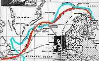
Forester fools ForesterThe Murmans convoy run
Halifax-Iceland-Murmansk
Vinland map
Internet mapFrancis Drake map fake
Jesuit fools Hitlerstupid
Yiddish: MicroSovmap and plate:
con-trick and prank
back to the chart room
 |
Universal World Atlas By Rand McNally & Company. They're in the USA, so don't blame them for emphasizing North America a bit. (This is a good deal.) |
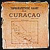 The Werbata Maps |
First topographic maps of Curaçao island, the Colony of Curaçao and Willemstad town, dating from begin 20th century. Reproduced on 2 CD-Roms. |
 |
Blaeu's Grand Atlas Reproductions of 17th Century Dutch maps. A joy to behold, and relatively cheap, too. Of course they're smaller than the originals. Too bad, but for most of us the only chance to get a look at 'em. |

 copyright notice